


Mount Shasta in a day
This article was also published on Medium. →
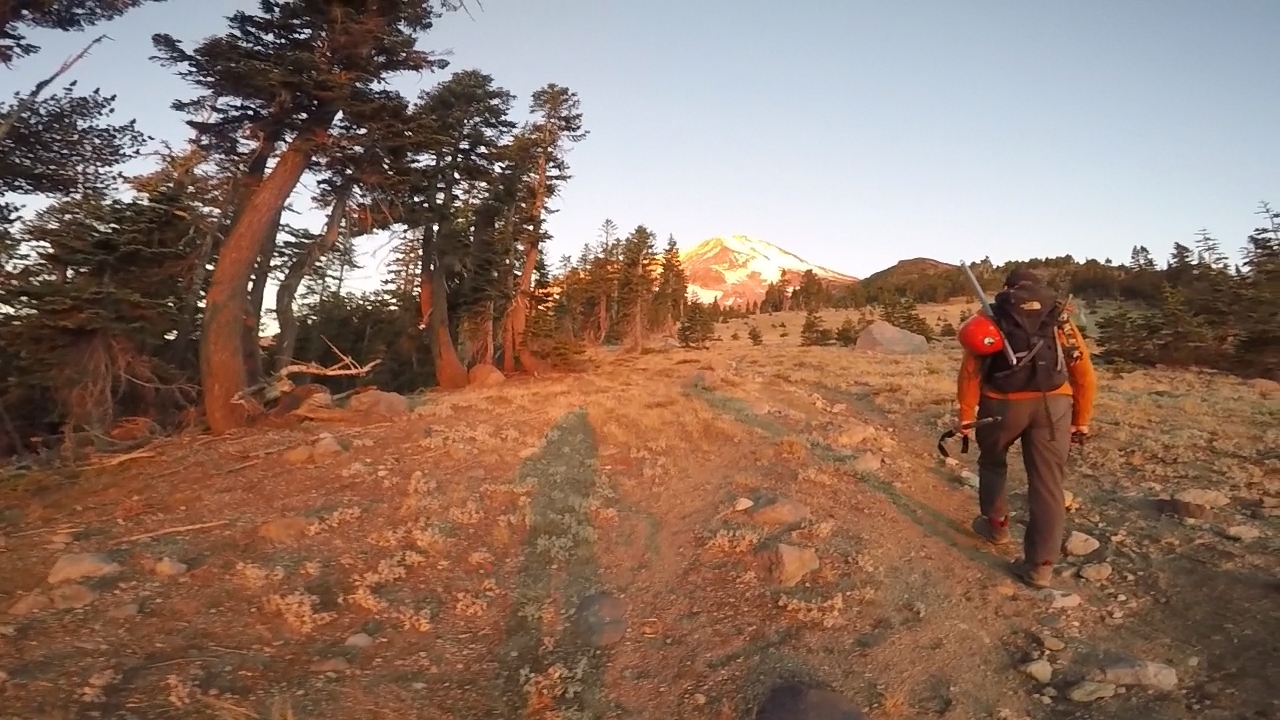
Tree branches carved long scratches into the paint of my Honda Civic. Driving close to the shoulder was my best bet to avoid the trenches carved out by more capable vehicles that mine would surely bottom out on. I was 6 miles down a rough dirt road that was getting worse and causing me some anxiety due to the low clearance of my vehicle. In the distance rose Mount Shasta, all 14,179 feet of it.
The remaining members of our group, two girls, had just dropped out of the trip due to adverse conditions on the mountain. A few winter storms had blown through the past couple of weeks and left snow on the mountain which could make climbing it more dangerous. Rangers had warned the climbing season was probably over.
It would just be me and the trip leader, Marco. I was confident enough in his previous experience with Shasta and his enthusiasm for continuing the trip that I decided not to back out. Besides, winter storms were expected for the following week so this was definitely the last opportunity of the year I would have to climb the mountain.
I arrived at Clear Creek trailhead and settled in for the night in the back of my car. My alarm woke me up at 4 am the following morning. Marco had arrived in the night and was already gearing up. We left our vehicles two hours later. An hour too late Marco grumbled.
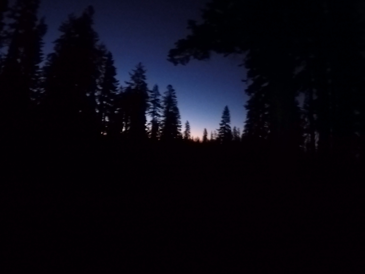
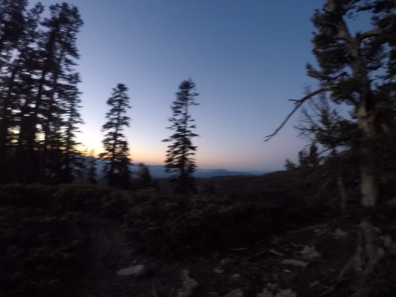
We marched for three miles through fir trees with our headlamps on in the dark. The sun began to rise and light up the landscape. It was beautiful.
Beyond the tree line we came upon a spring. The water came bubbling straight out of the ground. This would be the last stop for water, Marco said and I topped off my two water bottles, 3 liters in total. The water was cold and clean.
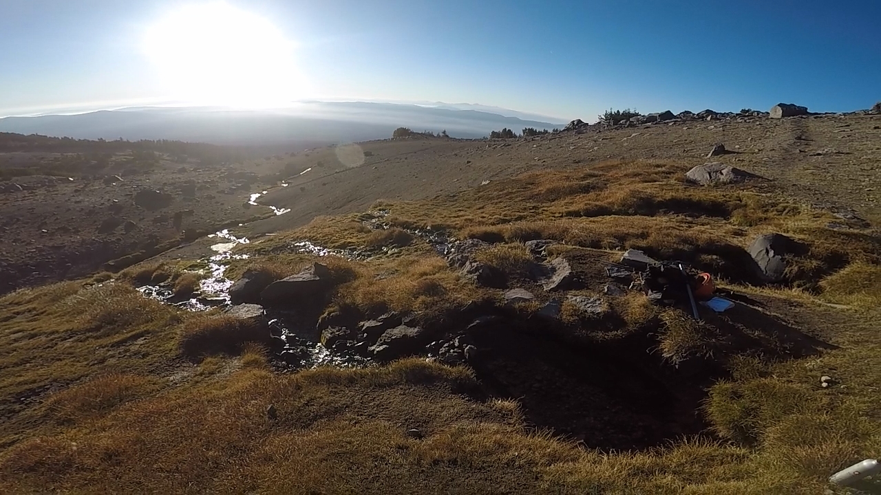
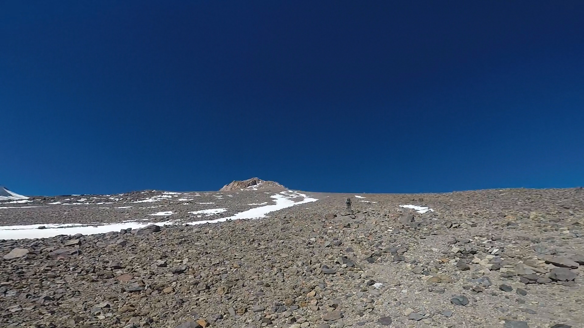
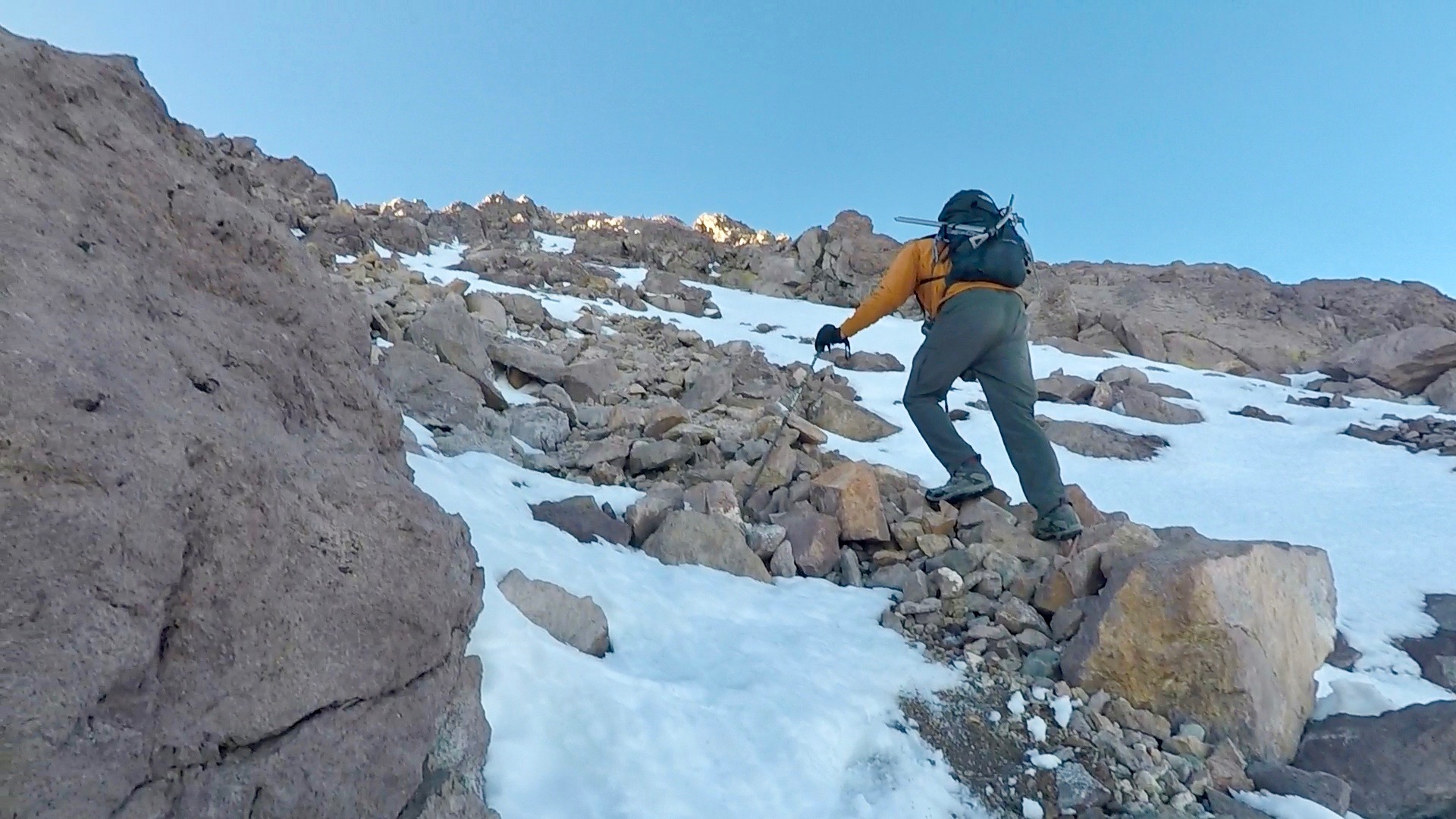
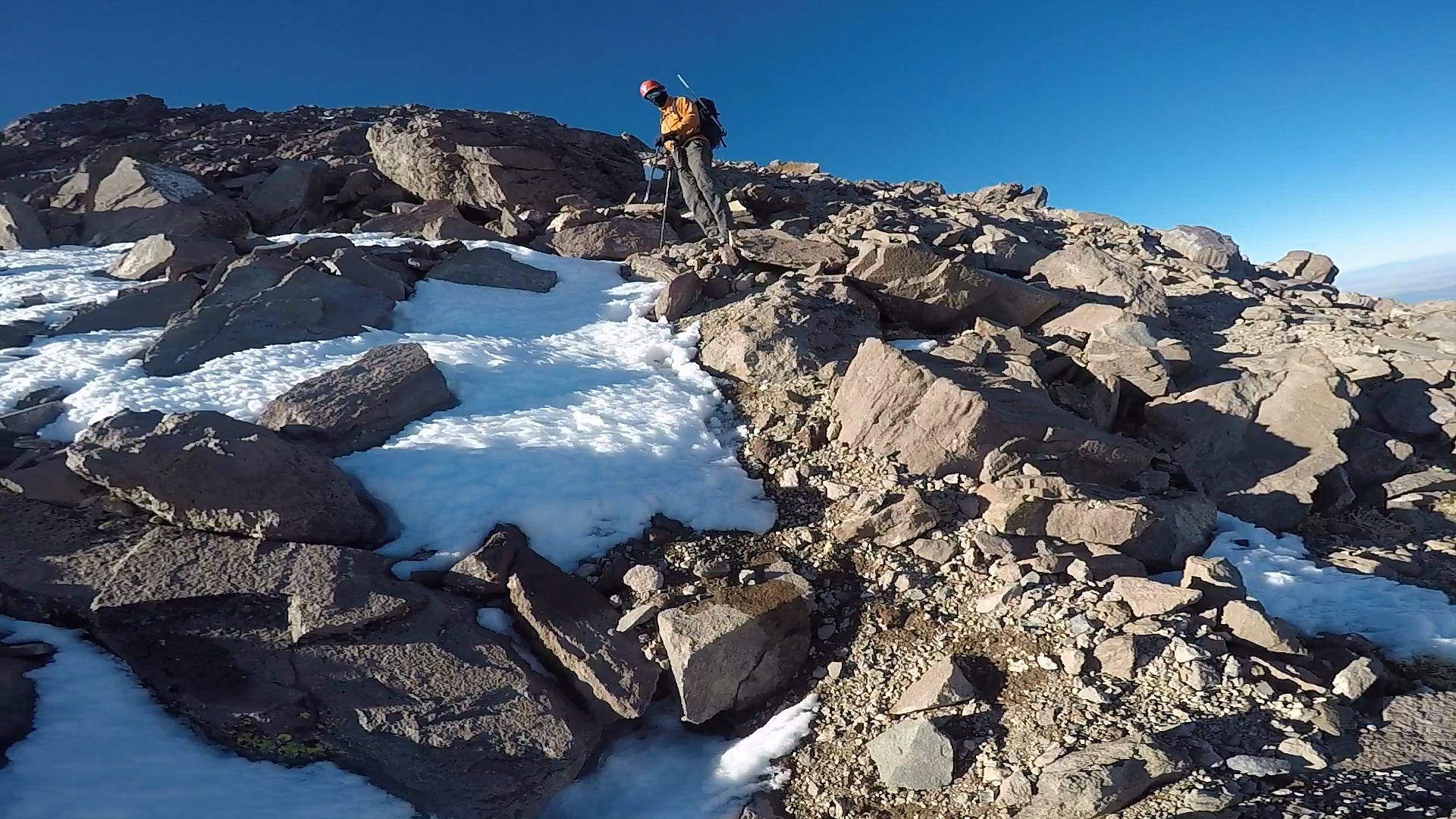
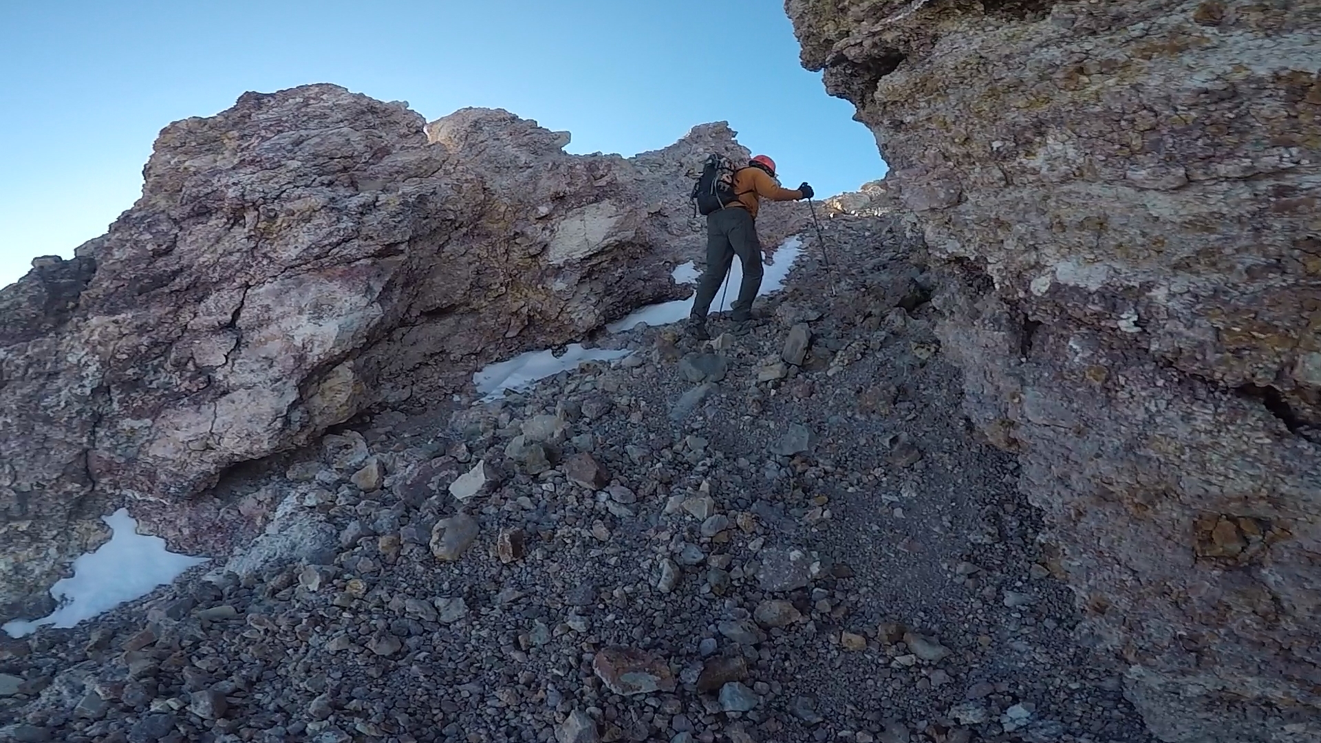
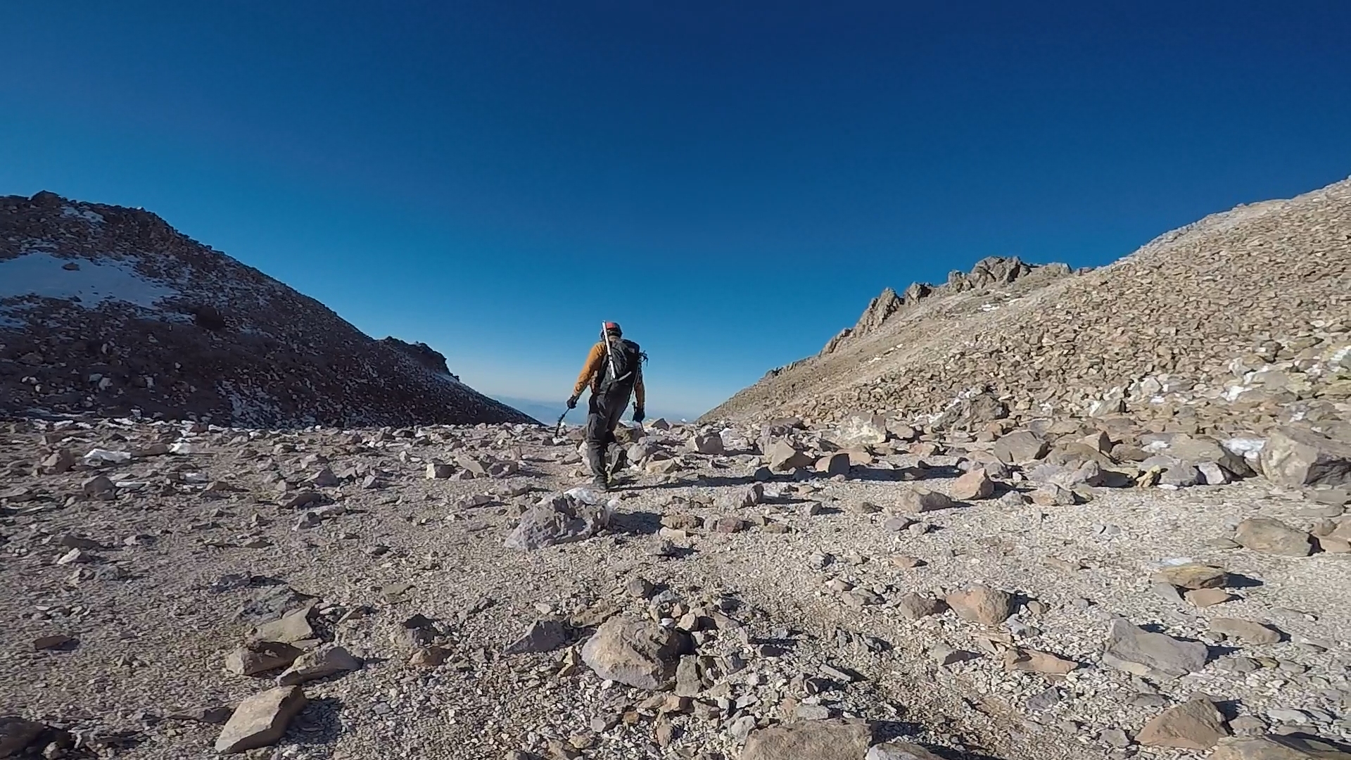
The landscape was beginning to get desolate, inhabited only by rock, ice and small trees. The trail was about to get much more difficult, Marco warned and he covered his face in a balaclava. Soon enough the trail was straight up through scree with fast elevation gain.
We ran into two other hikers, a young couple. They thought that they would summit by 2 pm or so and be back down the mountain before sunset. Marco corrected them. At best they would summit by sunset and be descending in the dark. This was our goal and we were prepared for the descent with headlamps but I think it scared them and they eventually turned around before they would have to face hiking in the dark.
Marco would point out landmarks in the distance, small peaks or big boulders and cautioned me that while they appeared close, they were still many hours away.
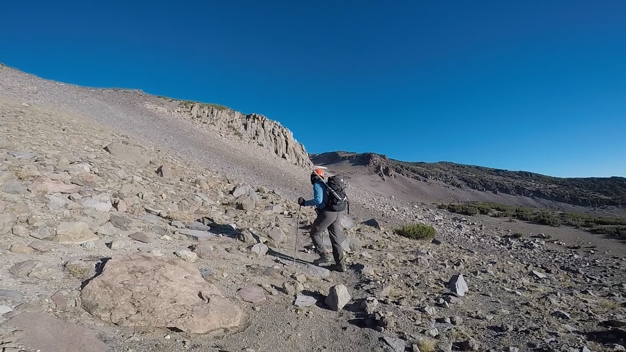
The trail gained more of a steep angle and the scree became tougher. Trudging up it was a little like doing stair master on difficult and it would last for many hours. For every three steps you moved up you would slide down one. It was fairly exhausting and would really test us, particularly as the altitude began to hit.
Our first destination was Red Rock. A croppy boulder field of large rocks that would signal the end of this strenuous traversal in scree and begin our scramble to the top. The altitude started to hit me closer to Red Rock. I felt a little bit light headed like I had been given some drug at the dentist.
I was familiar with altitude mountain sickness and I knew how dangerous it can be. I had turned around after camping at 12,000 feet on Mount Whitney the previous weekend after experiencing nausea and what I determined were the beginning symptoms of altitude mountain sickness. Combined with the strenuous huffing and puffing and my light headedness, I was beginning to feel some anxiety about pushing for the summit. We determined that we would make it to Red Rock and reassess how we felt and if we wanted to continue.
It must have been about 3pm when we made it to Red Rock. The landscape was much more rocky and strewn with large boulders. We stopped to eat. I ate a couple tortillas with salami and mayonnaise and mustard. I also had a 16 oz Rockstar energy drink which immediately boosted my energy and lifted my enthusiasm for pushing for the summit. We were both feeling good so we decided to push on.
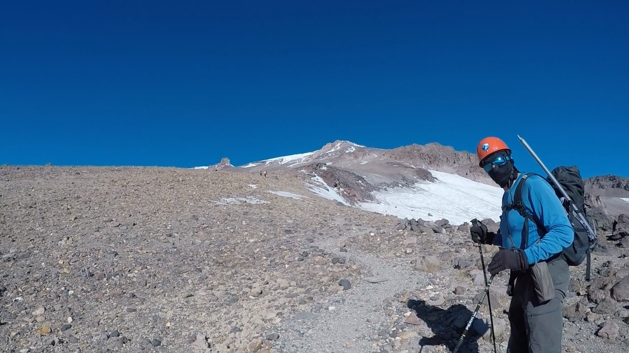
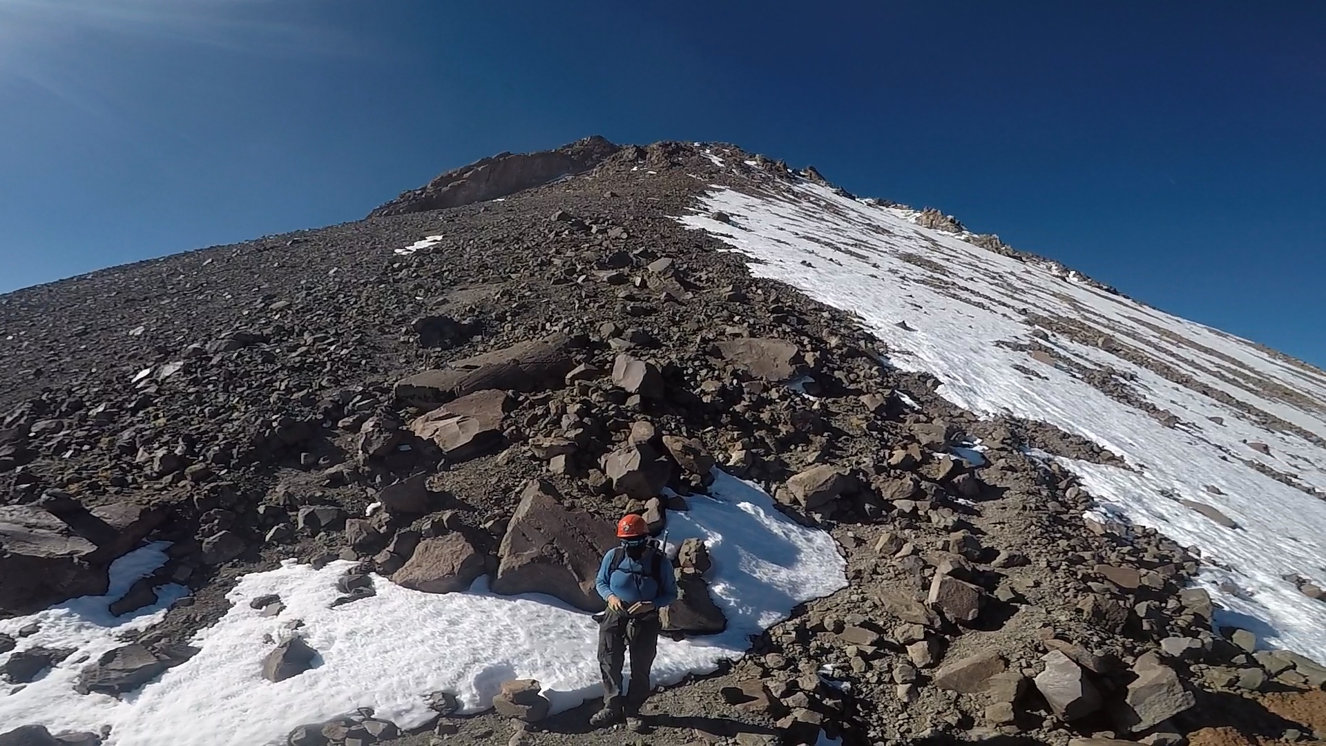
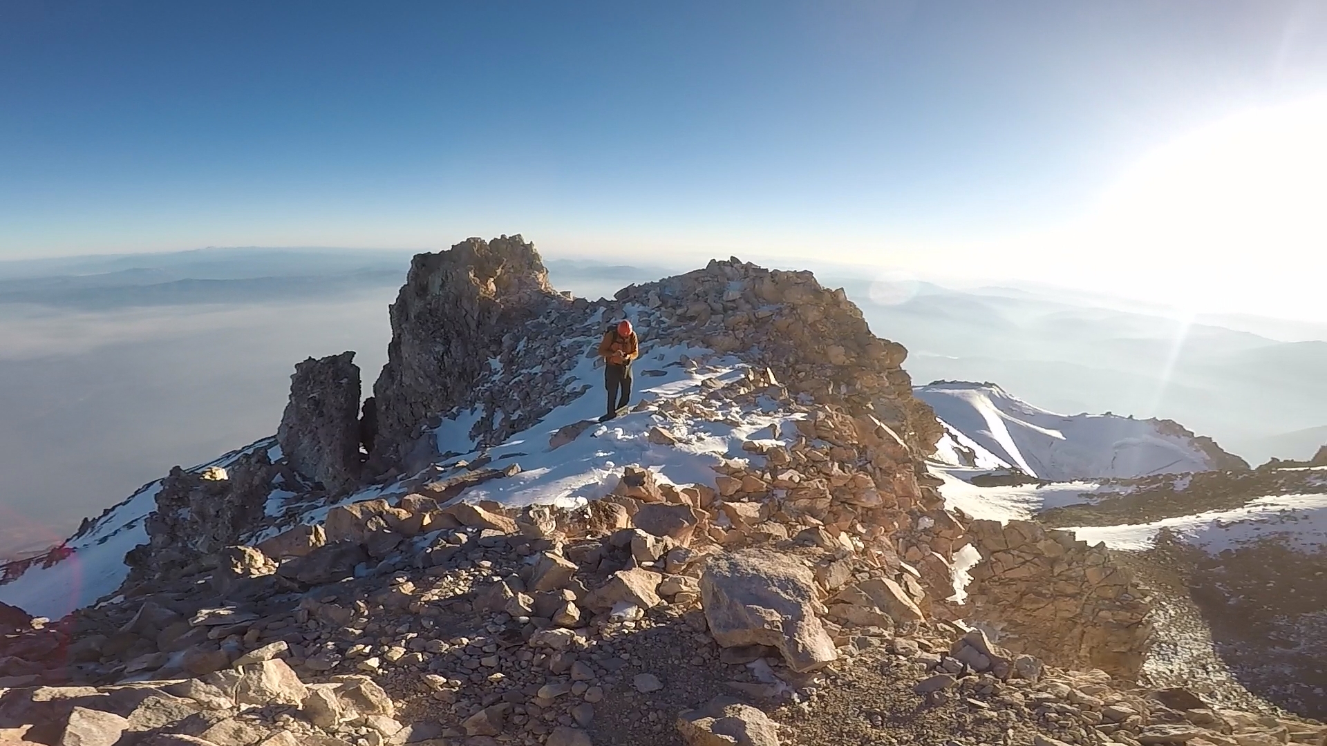
We entered a landscape with big boulders that required some class 2 scrambling. This was a welcome change as I found it much easier than the strenuous trudge through scree. The landscape started to level out when we could finally see the highest point on Shasta. Marco cautioned that while it looked close, we were still a few hours away from it.
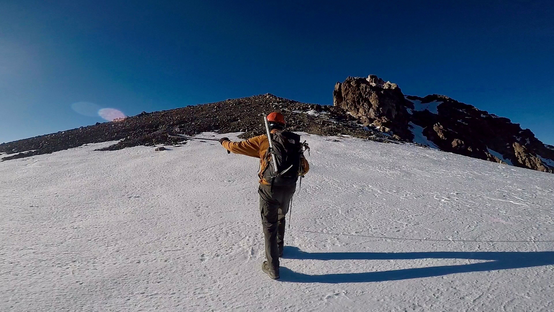
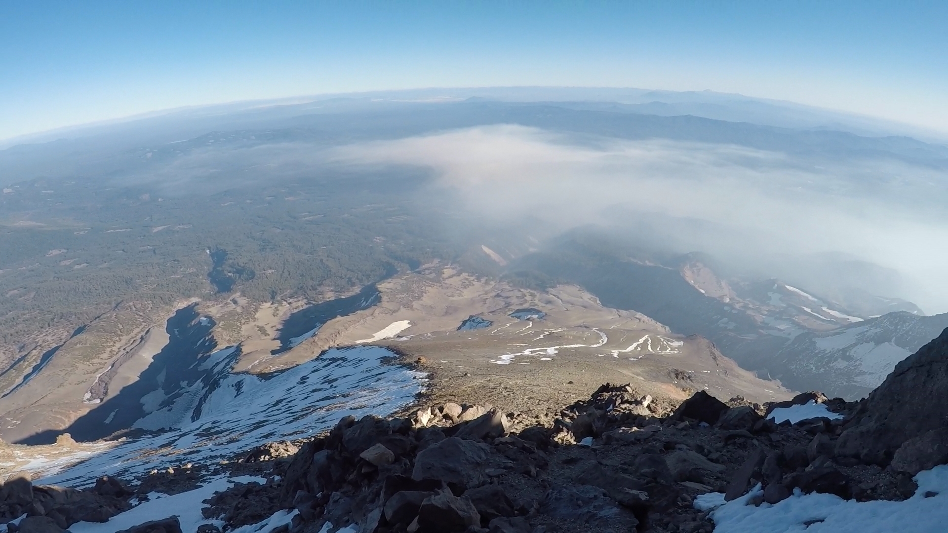
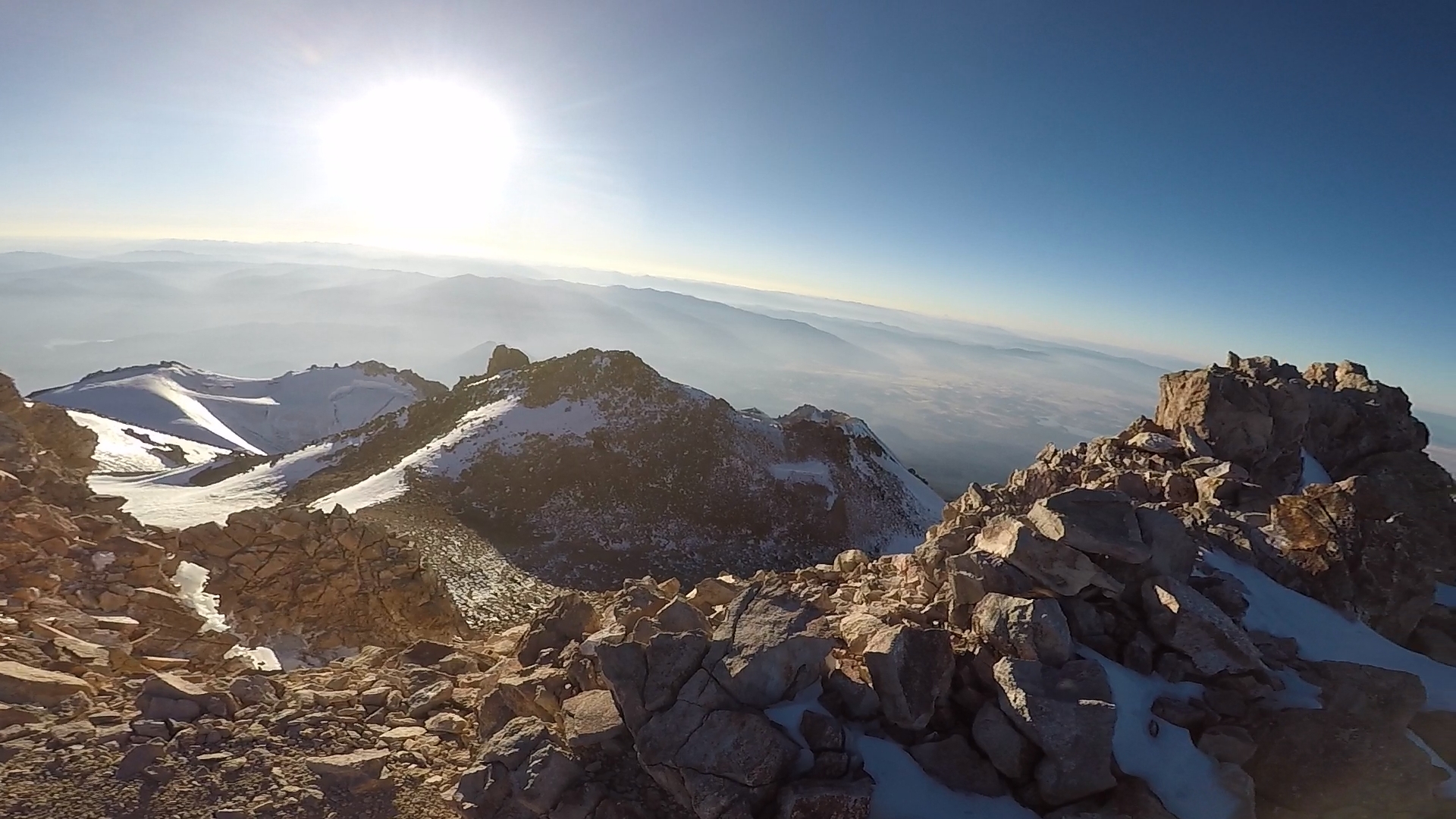
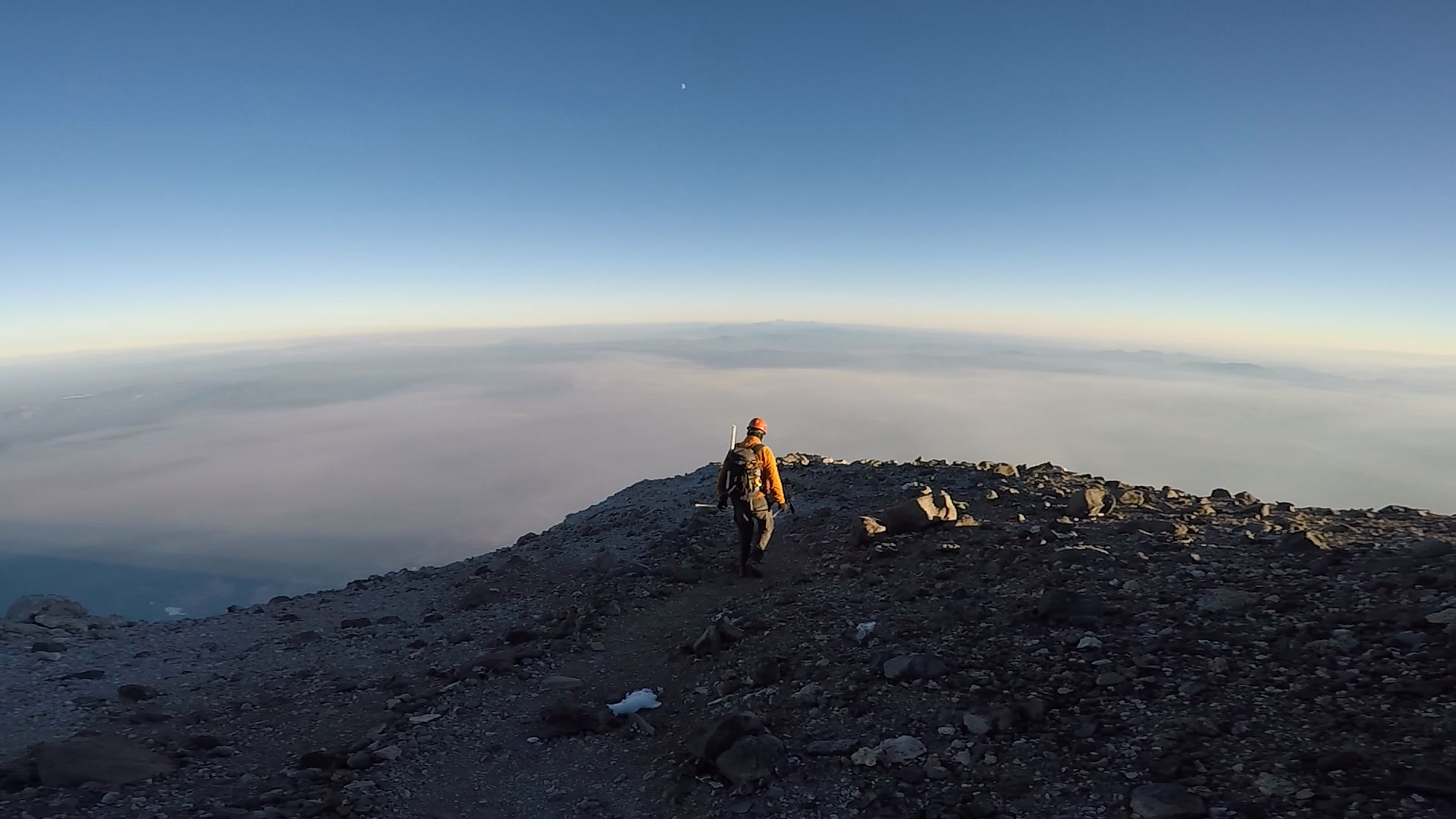
It was about 5pm when we reached the final plateau closest to the summit. I was immediately hit by a wave of sensations. First, there was a very pungent sulfur smell in the air from volcanic springs that came out of the mountain. This reminded me that this was still an active volcanic area. Second, the air must have been much thinner here because the altitude had a much stronger affect on me. I felt more light headed and I had a brief moment of anxiety as I stopped and considered turning back. I decided I felt well enough to push to the summit but I continued very slowly.
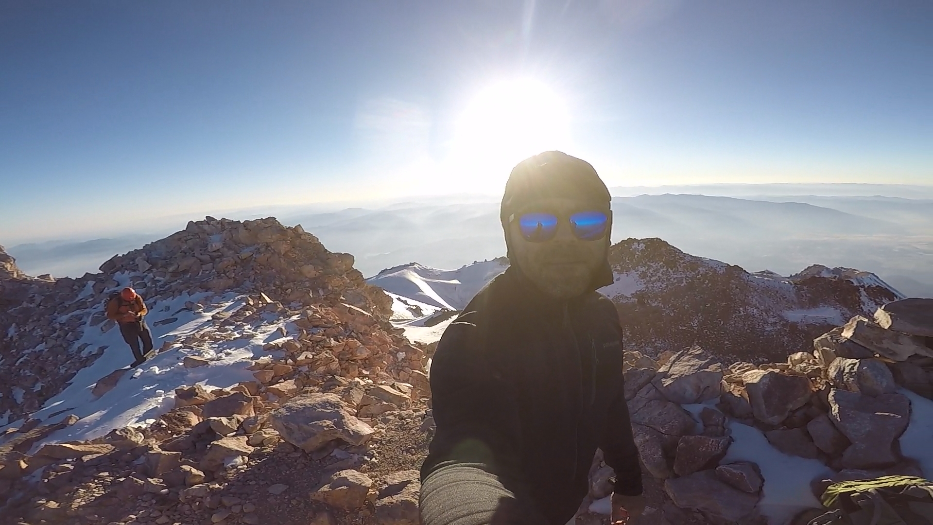
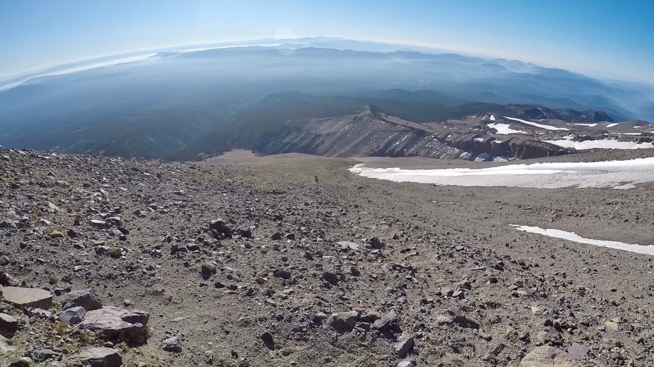
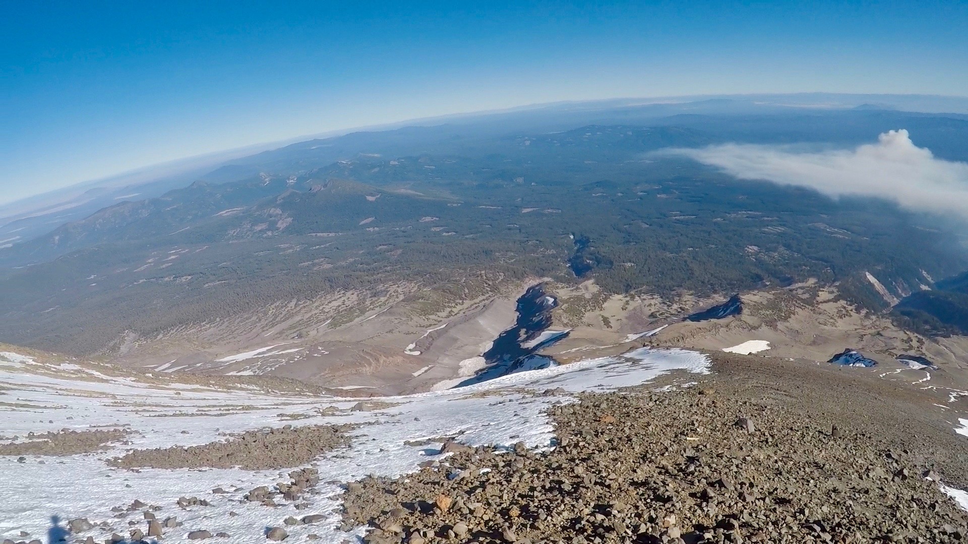
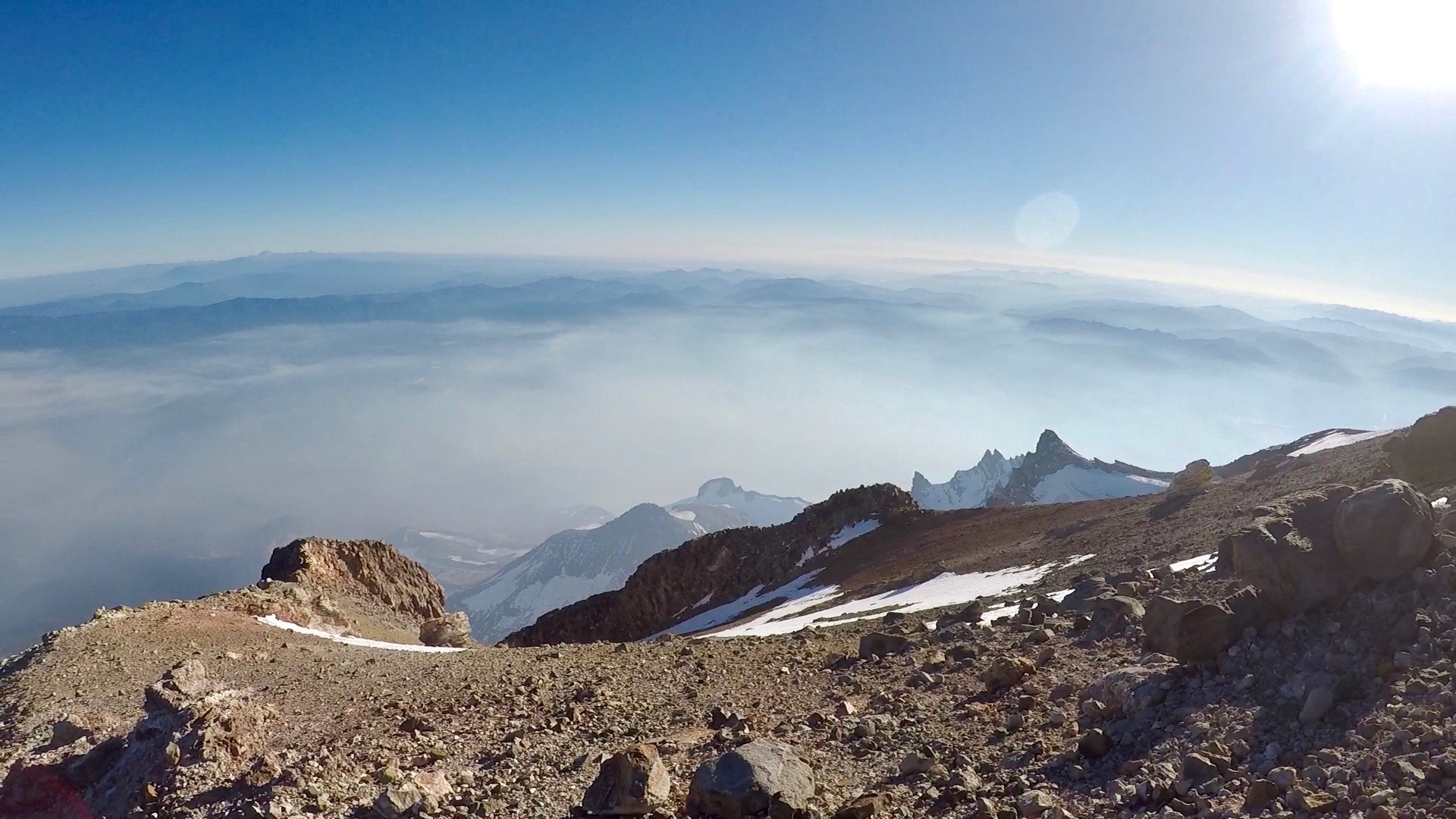
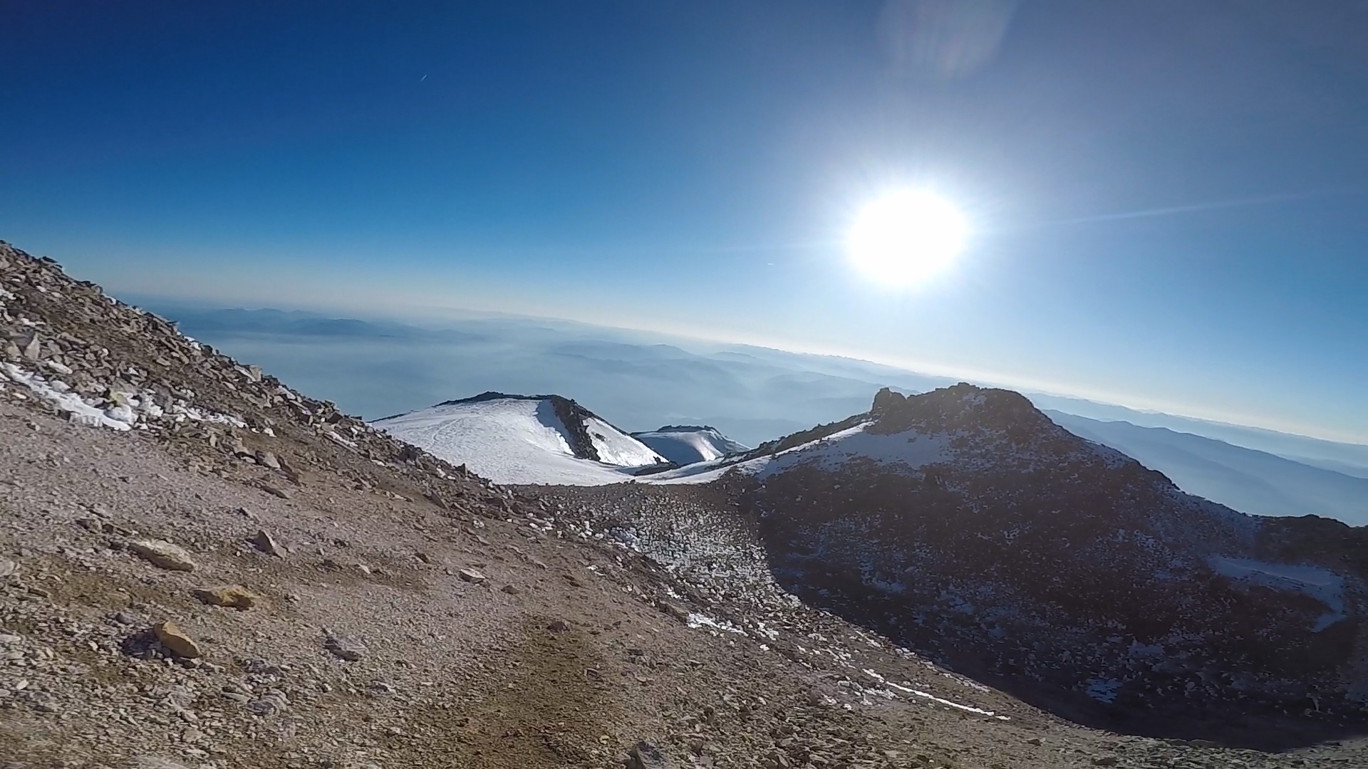
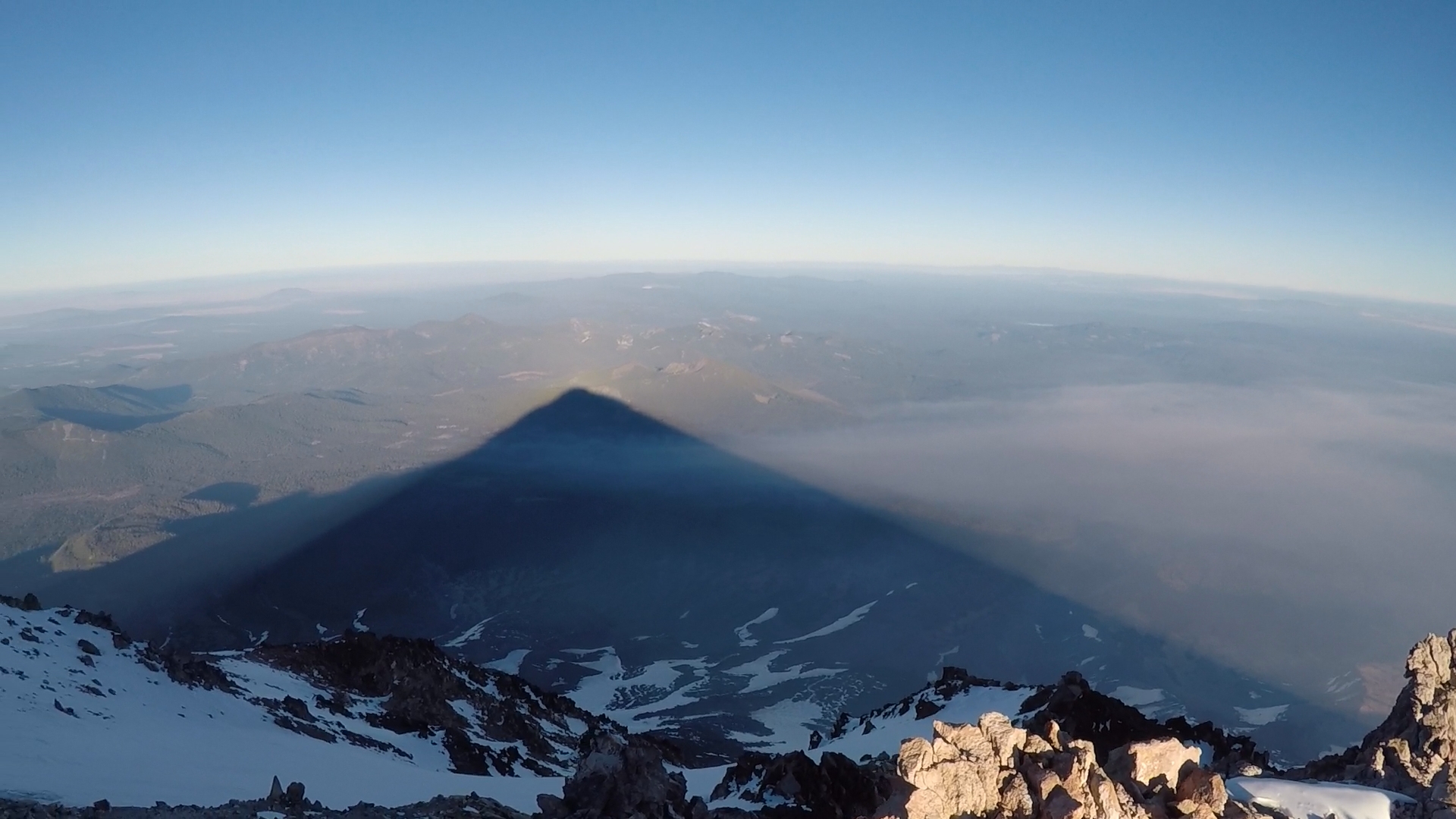
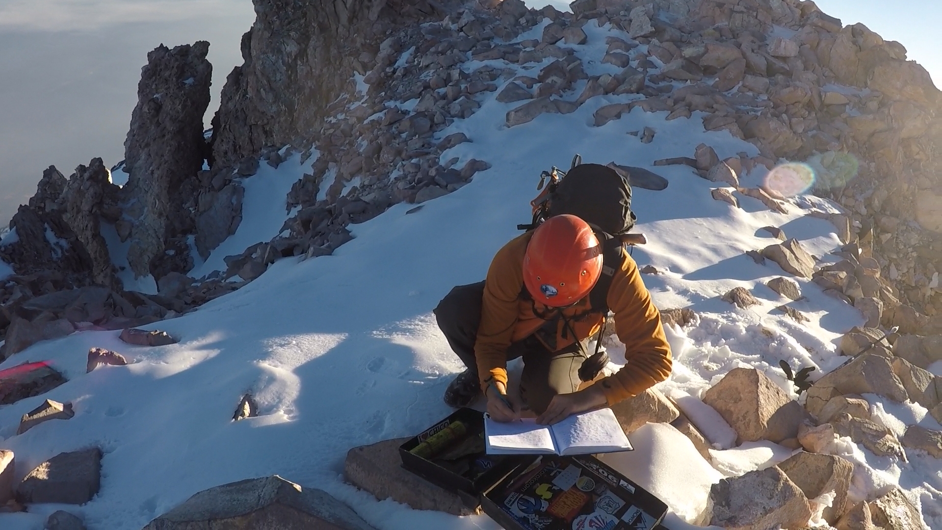
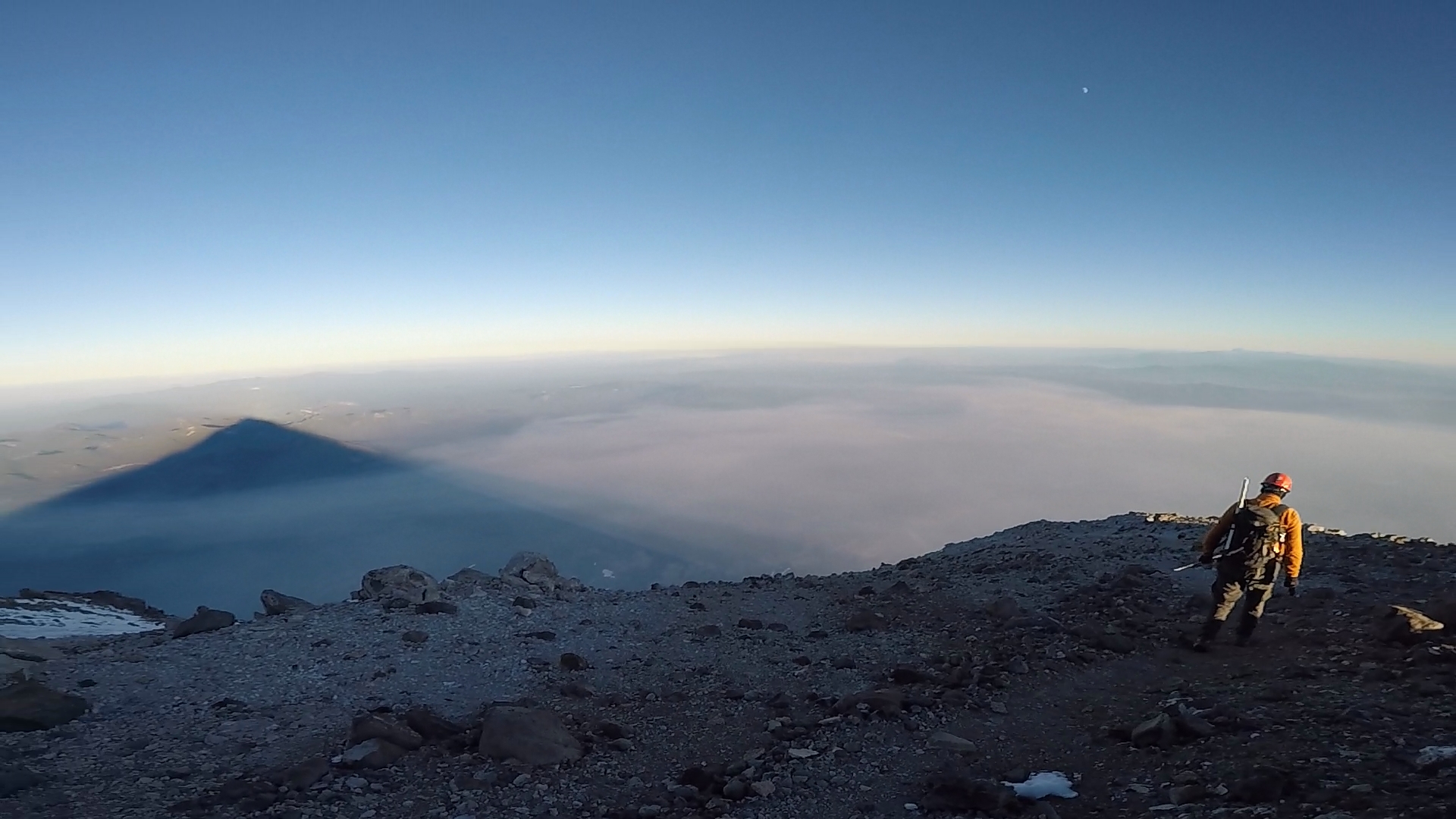
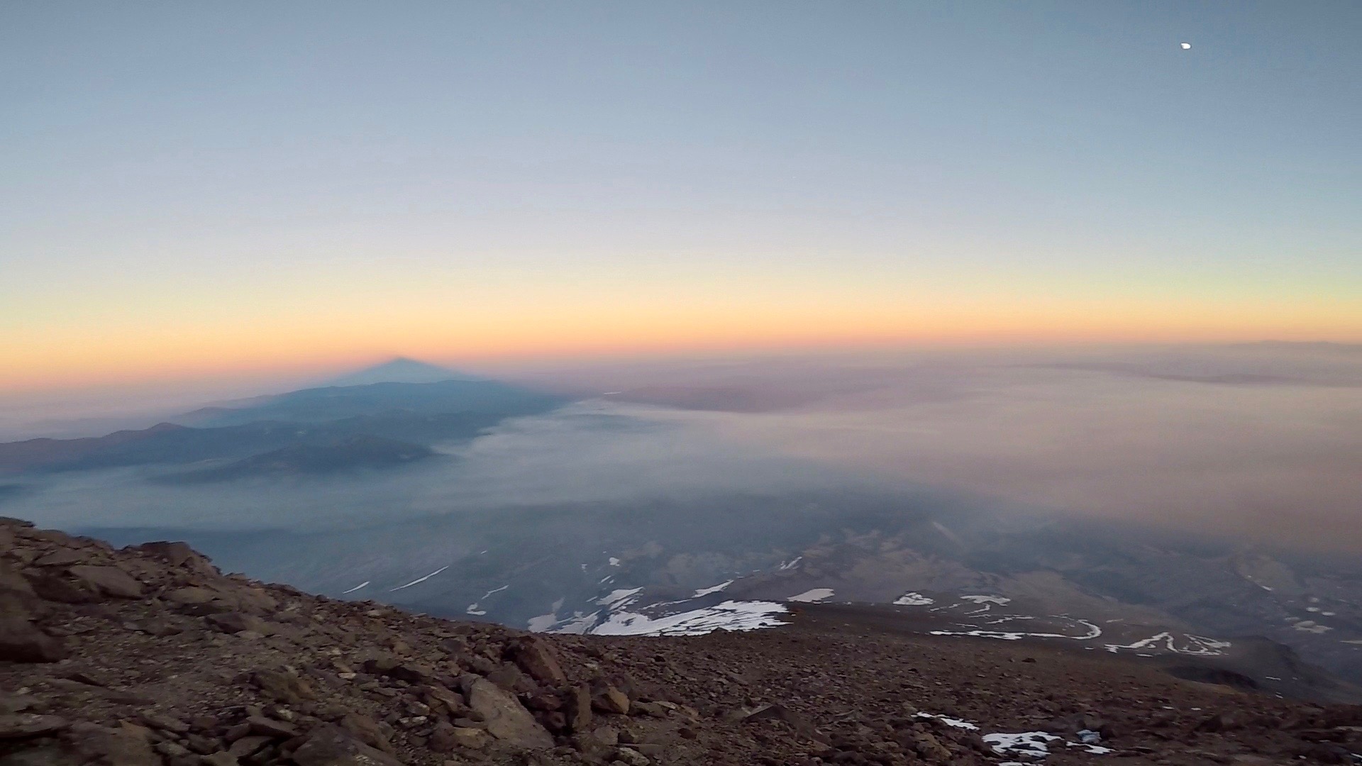
I felt exhilarated when I reached the summit. The view was knock out. Shasta cast a huge shadow to the south that looked like a giant pyramid. There is a book on the summit that you can sign. Marco and I both added our signatures.
The altitude was really taking a number on me and I felt the urge to descend. We had left distinct footsteps in patches of snow on the way up and it paid off helping us find our way down quickly. The last rays of the sun disappeared by the time we made it back to Red Rock and we switched on our headlamps. The affects of the altitude started to diminish here and I felt much better.
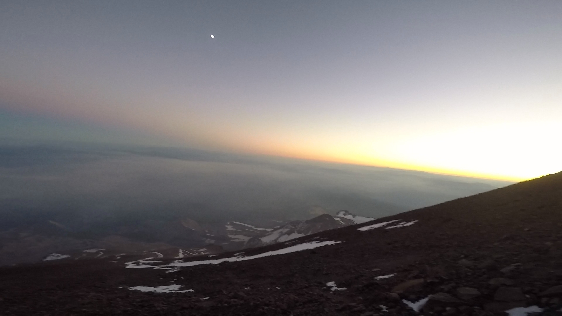
The night sky was clear as we hiked down the mountain and the moon was out but it was not bright enough for us to turn off our headlamps. It took us another 7 hours to make it back to our vehicles. We followed the main trail that is a series of switchbacks down the scree. We would lose the trail then spend some time looking for it. Coming down through the scree was much easier then going up and while my knees ached I was riding on a high of exhilaration from having reached the summit.
We considered glissading but the area where there was snow was quite steep and frozen. We worried that we would not be able to self-arrest and might injure ourselves or worse. Glissading is the act of sliding down a steep slope of snow while using your ice axe for support. Self-arrest is the technique of using your ice axe to brake while sliding or falling down ice or snow.
We had many good conversations on the trip. We both work with software so we talked about software engineering, the future of software development and Marco told me stories about his many trips up Mount Shasta and Mount Rainier.
We returned to our vehicles at 1 am the following morning. The trip total was about 7,800 ft of elevation gain, 16 miles round trip over 19 or so hours. I slept in my vehicle and left Shasta when I woke up after stopping off at Black Bear diner for a greasy breakfast. Marco stayed and rested then did the whole mountain again the following day by himself. What a beast.